Ground access, reviewed in the aircraft.
The crew reviews the requester, gimbal-control permission, and session length on the iPad, then approves or denies access.

VoxNet / The ground connection
View live imagery, request gimbal control, and review recordings and mapped observations from authorized aircraft. The live connection depends on connectivity and crew-granted access.
Request a demo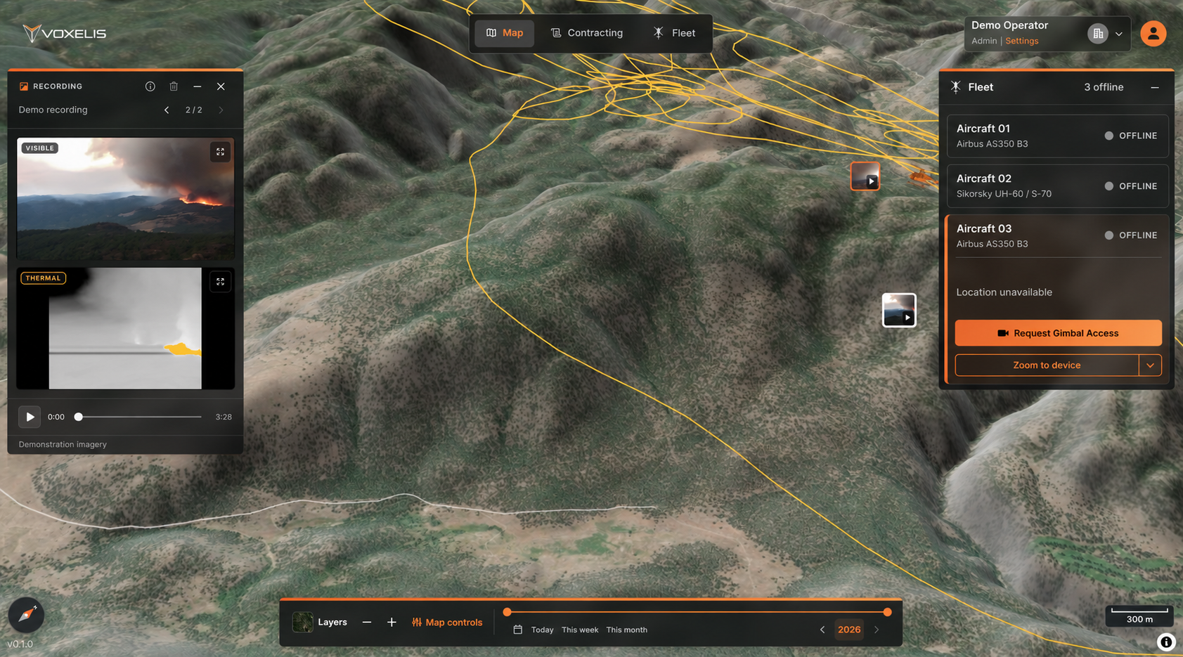
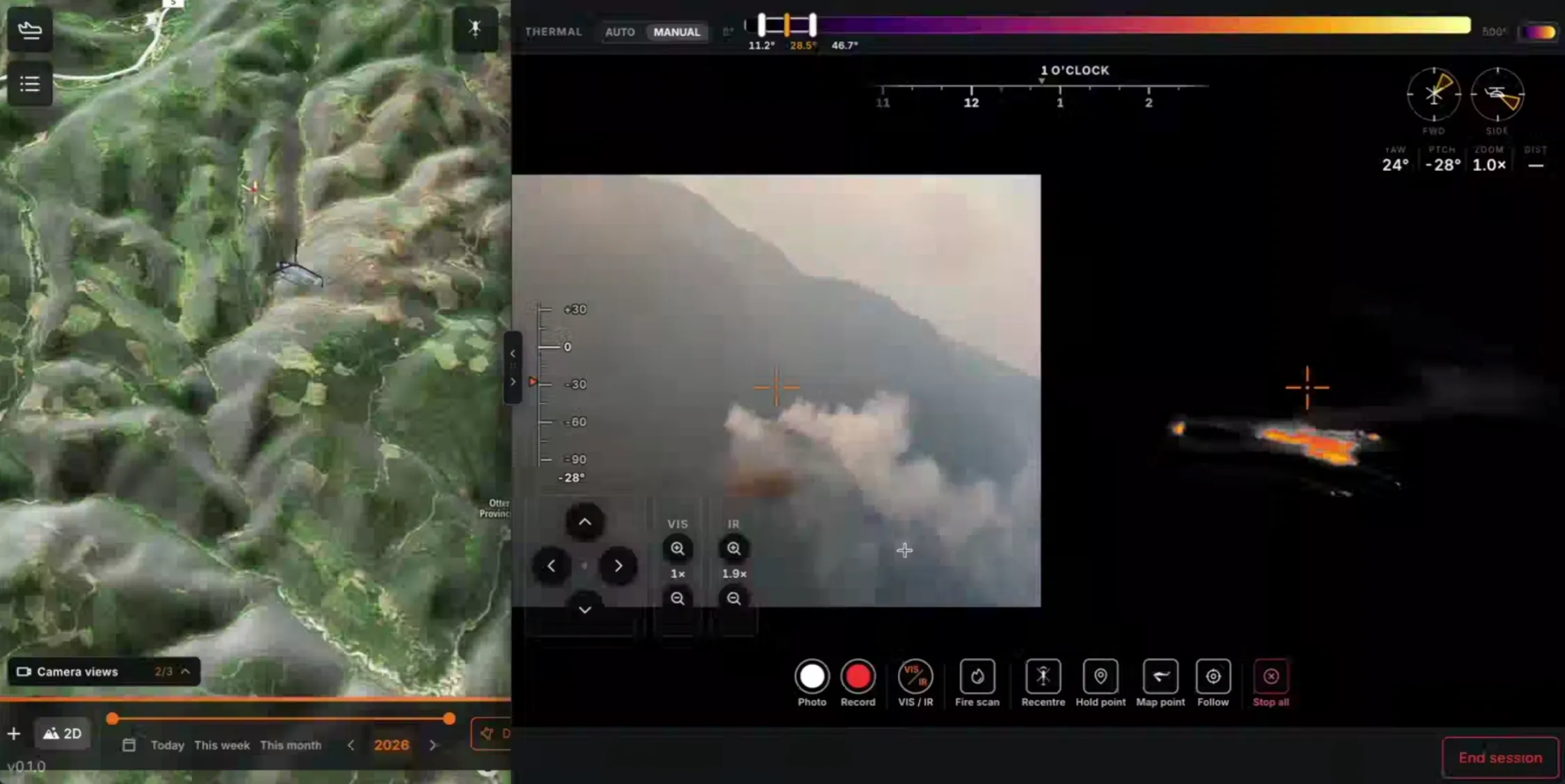
Stream imagery live and control the gimbal from the ground, giving authorized teams an active view of the mission.
Put imagery alongside terrain, flight tracks, and fleet status. Keep the observation connected to where it happened.
Receive recordings and intelligence in near real time, with exportable outputs for your operational workflow.
Wildfire / Available capabilities
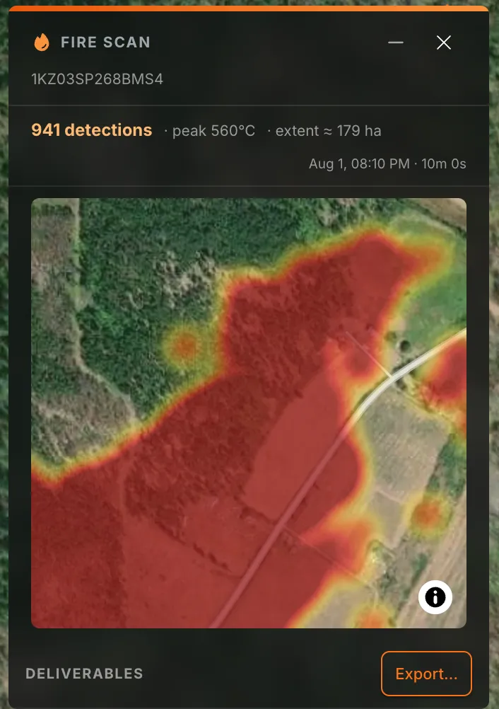
Review detected areas, examine temperature estimates, and export the scan for response planning.
From aircraft to team
Keep live imagery connected to its time and location, so aircraft crews and ground teams can review the same observation.
The crew reviews the requester, gimbal-control permission, and session length on the iPad, then approves or denies access.
Stream the aircraft view and control the gimbal remotely from the ground. Viewing, control, and delivery depend on connectivity and the access granted for the operation.
See aircraft status and tracks in the same workspace as mission imagery, with time and location providing context for review.
Data governance, built in.
That matters more than ever. VoxNet was designed for agency control from the outset, with fine-grained permissions and visibility into data access, sharing and use.
Define who can access data, for what purpose, and what they can share. Scope permissions to the operation and review or revoke access as requirements change.
Maintain visibility into access and sharing through audit records, so your team can trace how information moves between authorized recipients.
Encryption and tenant isolation are built into the architecture. Fully sovereign deployments and separate cloud environments are available for agency requirements.
Designed for GIS integration
Review the outputs, access requirements, and connections your analysts and operational teams need.
Practical details
VoxNet brings together recordings, imagery, and mapped observations. Fire scans provide automatic detections, mapped fire extent, temperature estimates, and exports.
The aircraft crew can approve or deny a remote-access request. The iPad request shows the requester, requested gimbal-control permission, and session length.
Live streaming, remote gimbal control, and near-real-time delivery require high-speed internet, which is not included. We’ll review connectivity requirements for your operation.
Fire-scan exports are available today. Share the formats, map layers, and operational tools you need so we can confirm the supported outputs and integration scope for your workflow.
Hosting and data location, access permissions, retention, ownership, and any permitted model-training use. We’ll scope these requirements with your team before deployment.
Looking ahead / Planned capability
We’re exploring a way for newsrooms to request aerial images and video through VoxNet.
Help shape this capabilitySee how it fits
Explore live access, fire-scan results, and the outputs your team needs.